Our field application is your partner in agricultural consulting. With our app, farmers can implement smart farming easily and fully automatically. It creates customized application maps based on high-resolution satellite data. Better yields with optimized use of resources — exactly what farmers need.
You have a say! Our app was developed in collaboration with farmers and agricultural consultants. We continuously adapt it to the needs of our users and also integrate individually required modules for you.

Daily updated information on temperature, precipitation, and vegetation indices

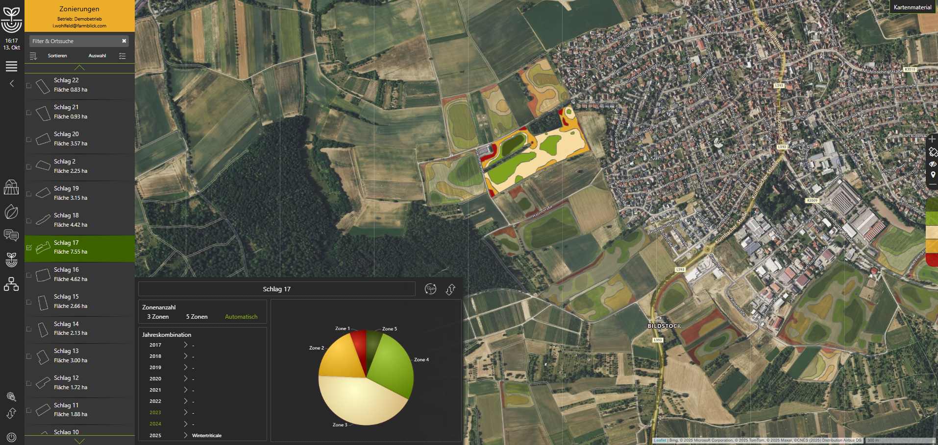
Classification of fields into management zones based on soil properties, past yields, etc.

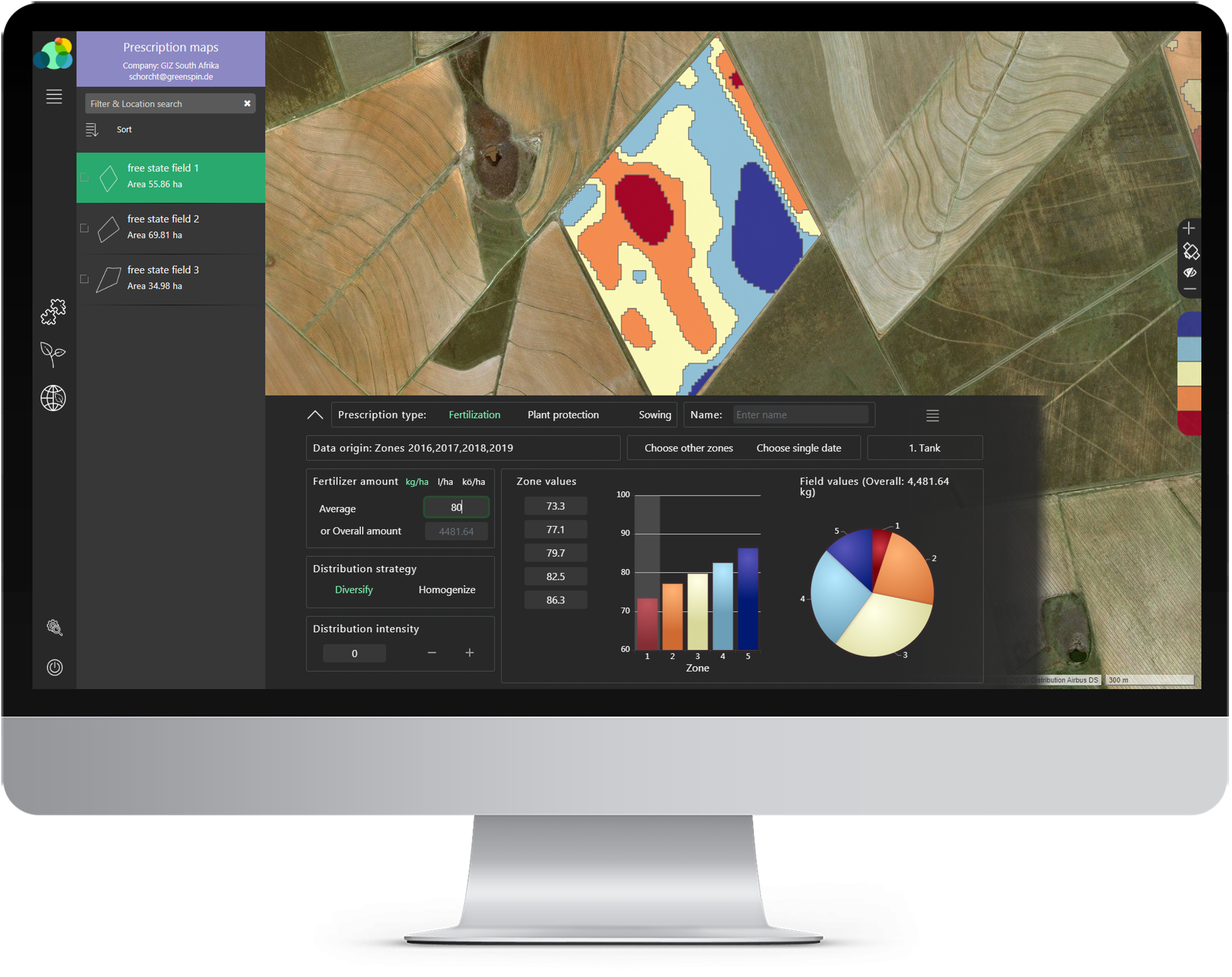
Based on management zones, current weather conditions, and vegetation status from satellite data

Automatic calculation and implementation of the optimal lane, skipping the lane for applications

Functions of the Isaria Connect Platform for Isaria sensors integrated
Learn more

Directly from the app to the machine terminal, compatible with John Deere, ProFlura, and CLAAS, and various file formats

For over 10 years, our application has been helping farmers with smart farming

One click and the machine automatically implements the required management

User-friendly, globally accessible interface, developed with farmers and agricultural consultants